Creating a Detailed Hiking Itinerary: Time, Distance, and Elevation
Start by calculating daily mileage using 2-3 mph on flat terrain and 1-2 mph in mountains. Apply Naismith’s Rule: one hour per three miles plus one hour per 2,000 feet of ascent. Subtract two miles from daily targets for every 1,000 feet of elevation gain. Map key landmarks using topographic maps for navigation points and motivation. Build 20-30% buffer time into each trail segment for weather delays and navigation challenges. The complete system transforms chaotic adventures into precisely orchestrated expeditions.
We are supported by our audience. When you purchase through links on our site, we may earn an affiliate commission, at no extra cost for you. Learn more. Last update on 21st June 2026 / Images from Amazon Product Advertising API.
Notable Insights
- Calculate daily mileage using 2-3 mph on flat terrain and 1-2 mph in mountains, applying Naismith’s Rule for time estimates.
- Subtract 2 miles from daily targets per 1,000 feet of elevation gain to account for increased difficulty and energy expenditure.
- Use topographic maps to identify key landmarks and measure distances between points for navigation security and route planning.
- Add 20-30% buffer time per trail section and plan 1-2 extra days for weather delays and navigation challenges.
- Integrate GPS systems with offline mapping capabilities to enhance route safety through cross-verification and real-time navigation assistance.
Choosing Your Destination and Route Length
Where you choose to hike fundamentally determines your entire outdoor experience and required preparation level.
Natural landscapes vary dramatically between destinations like Australia’s diverse terrain and Scotland’s mountainous regions. Trail accessibility differs markedly-Scotland provides well-marked routes with established tourist infrastructure, while remote locations require advanced navigation skills.
Cultural experiences enhance hiking value. Spain’s Camino de Santiago combines scenic beauty with historical significance, offering enrichment beyond physical exercise. Safety considerations rank countries like Australia and Luxembourg highest for environmental preservation and hiker security.
Route length directly impacts planning complexity.
Short day hikes like Australia’s Three Sisters Walk require minimal preparation, completing in under one hour. Multi-day treks such as Tour du Mont Blanc or the Appalachian Trail demand extensive logistics, equipment planning, and time commitments spanning weeks to months. Popular destinations like Diamond Head in Hawaii see over 3,000 daily visitors despite being a relatively short 1.6-mile round trip hike. Timing your hiking season matters significantly, with May and September offering the most favorable weather conditions for optimal trail experiences.
Your backpack capacity should align with your chosen route length, requiring 10-30 liters for day hikes and 40+ liters for overnight adventures.
Breaking Down Distance Into Daily Segments
You’ll need to calculate realistic daily mileage targets based on your group’s fitness level and the terrain you’ll encounter.
Start by estimating 2-3 miles per hour on flat terrain, but reduce this to 1-2 miles per hour for mountainous areas with significant elevation gain.
Map key landmarks like water sources, campsites, and scenic viewpoints to establish natural stopping points that align with your daily distance goals. Many hikers find that pursuing enjoyment over distance leads to more satisfying group experiences, especially when balancing ambitious mileage goals with the diverse fitness levels typically found in hiking groups. Factor in adequate time for scenic stops when calculating your overall hiking schedule, as these planned breaks will impact your total mileage coverage for each day.
Consider your backpack capacity when planning daily segments, as day hikes typically require only 15L while weekend trips need 35-40L and extended adventures demand 50L packs.
Calculate Daily Mileage Targets
Accurate daily mileage calculations form the foundation of any successful hiking itinerary, transforming your total trail distance into manageable daily segments that match your fitness level and experience.
Daily distance considerations must account for individual fitness levels, ranging from 8-12 miles for beginners to 16-20 miles for experienced thru-hikers.
Start with Naismith’s Rule: hiking time equals miles divided by three, plus elevation gain in feet divided by 2,000. This formula provides baseline estimates for mountainous terrain.
Key calculation factors include:
- Elevation impact: Subtract approximately 2 miles from daily targets per 1,000 feet of elevation gain
- Personal pacing: Average hiking speed ranges from 2-3 mph on moderate terrain
- Environmental variables: Weather, trail conditions, and pack weight considerably affect daily mileage capability
Always build flexibility into your calculations for unexpected delays. Consider scheduling strategic rest breaks throughout your hiking day to maintain energy levels without losing overall momentum.
Many hikers utilize the straightforward approach of averaging 2 miles per hour while breaking down distances into smaller segments for improved planning accuracy.
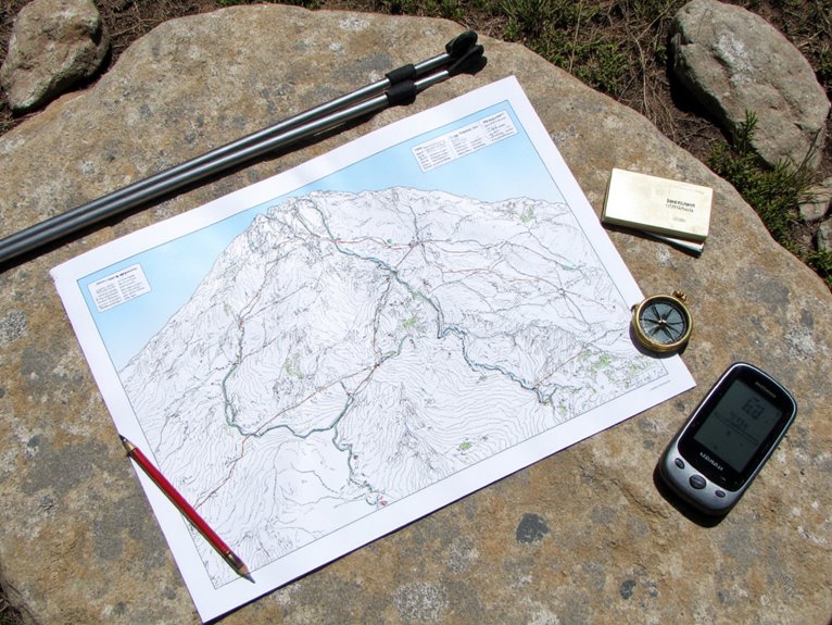
Map Key Landmarks
Strategic landmark identification transforms your hiking route from an overwhelming distance into a series of achievable waypoints that provide both navigation security and psychological motivation. Effective landmark identification requires selecting prominent, stable features like mountains, rivers, and rock formations that remain recognizable across varying weather conditions.
Break your total trail distance into daily segments using these landmarks as logical stopping points. Each segment should target specific terrain features for route verification purposes. Use topographic maps to calculate distance and elevation gain between landmarks, ensuring realistic daily targets.
When planning your route, prioritize ridge lines as they typically offer lower construction costs for trail builders and provide scenic overlooks that enhance the hiking experience. This strategic approach helps you identify the most rewarding viewpoints while following established trail corridors. Different tree species can also serve as valuable indicators of elevation changes and terrain type as you move between major landmark waypoints.
Modern GPS devices can help confirm your landmark identification and provide backup navigation when visibility is poor, with many models offering preloaded topographic maps and multi-GNSS capability for accuracy within five feet.
| Landmark Type | Visibility Range | Navigation Value |
|---|---|---|
| Mountain Peaks | 5-20 miles | Excellent triangulation |
| River Crossings | 0.5-2 miles | Water source confirmation |
| Rock Formations | 1-5 miles | Reliable position fix |
| Ridge Lines | 2-10 miles | Directional guidance |
| Trail Junctions | Immediate | Route decision points |
Constantly verify landmark visibility against your map to maintain accurate position awareness throughout your hike.
Analyzing Elevation Gain and Terrain Challenges
When planning any hiking route, understanding elevation gain proves essential for accurately estimating difficulty and required effort.
You’ll encounter significant differences between guidebook measurements and GPS app calculations. Apps typically report 10-15% higher total ascent because they sum every uphill segment, while guidebooks often use simple start-to-finish elevation differences.
Terrain variations create distinct hiking challenges that require careful profile analysis:
- Easy terrain: Under 500 feet gain per mile on gentle slopes
- Moderate climbs: 500-1,000 feet per mile with noticeable effort required
- Strenuous ascents: Over 1,000 feet per mile demanding significant conditioning
Elevation fluctuations on rolling terrain increase total ascent without reflecting in basic gain calculations. Understanding route types helps determine whether you’ll return via the same path or complete a circular journey.
Cross-reference multiple sources for accurate measurements, as GPS precision varies between platforms. Extended hikes may require zero days for rest and resupply, particularly when facing challenging elevation profiles over multiple weeks.
Cold weather conditions significantly impact hiking performance, making proper thermal regulation gear essential for maintaining body temperature during elevation changes.
Calculating Realistic Hiking Times and Pacing
Beyond understanding elevation profiles, you’ll need reliable methods to estimate how long your planned route will actually take. Naismith’s Rule provides a foundation: one hour per three miles plus one hour per 2,000 feet of ascent.
Your hiking speed varies considerably based on terrain impact-rough surfaces can halve your pace compared to maintained trails. Fitness levels directly affect these calculations, requiring personal adjustments to standard formulas. Weather factors like wind or rain add 20-30% to estimated times.
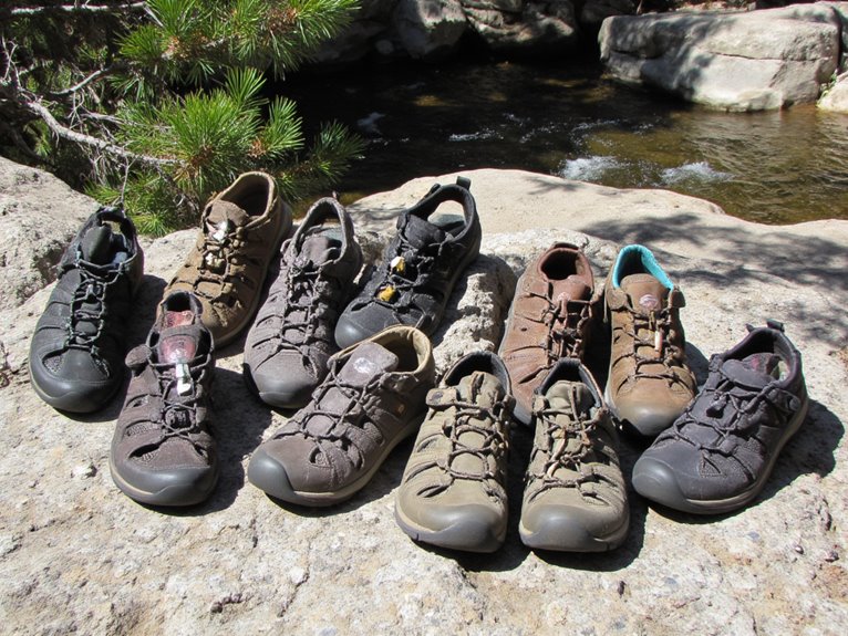
Effective pacing strategies involve segmented calculations for ascent, descent, and flat sections. Altitude effects reduce speed above 8,000 feet due to oxygen limitations. Always include break adjustments of 10-15% for rest periods. Trail conditions such as mud or loose rocks demand additional time buffers. Proper hiking shoes with features like deep lugs for traction on rocky trails or waterproof construction can significantly impact your actual hiking pace and safety margins.

Although accurate time calculations provide your foundation, they can’t account for weather shifts and navigation challenges that routinely derail hiking schedules.
Weather sensitivity demands buffer margins since forecasts achieve peak reliability only within 84-hour windows before departure. Research indicates traditional hiking estimates underestimate actual times by 30-70 minutes, establishing baseline buffer requirements.
Navigation precision decreases on unmarked terrain or off-trail segments, necessitating additional contingency time. GPS platforms contain data gaps requiring route confirmation during hikes.
Essential buffer strategies include:
- Segment-based buffers: Add 20-30% extra time per trail section
- Weather contingency: Plan 1-2 extra days per hiking week for multi-day trips
- Navigation margins: Allocate extended time for complex terrain or limited trail markings
Conservative time margins reduce schedule pressure while improving safety outcomes in challenging environments.
Organizing Your Digital Itinerary System
You’ll need a structured digital system to manage your hiking itinerary‘s multiple components effectively.
Start by creating dedicated folders for route maps, permit documentation, weather forecasts, and GPS data files in your preferred cloud storage platform.
Modern hiking apps like Wanderlog and specialized mapping tools can integrate directly with your GPS device to automatically sync waypoints, elevation profiles, and track data into editable templates that you can modify before each trip.
When planning for extended hikes, consider including information about hiking insoles in your gear checklist to ensure optimal comfort and reduce fatigue during long trail days.
Digital Folder Structure Setup
Creating an effective digital folder structure starts with establishing a main folder labeled “Hiking Trips” that serves as your central repository for all hike-related files.
This systematic approach to folder organization guarantees you’ll locate documents quickly when planning or during actual hikes.
Implement these essential organizational components:
- Trip-specific subfolders using descriptive names like “Grand Canyon Hike” or “Mount Everest Trek”
- Year and month breakdowns within each subfolder for chronological access
- Document categories separating maps, permits, and guidebooks into distinct sections
Cloud storage services like Google Drive enhance accessibility across devices.
Configure your hierarchical structure with consistent naming conventions throughout all subfolders.
Store trip itineraries, permit documentation, and safety guidelines within each designated folder.
This centralized system prevents file loss while enabling seamless collaboration with fellow hikers through shared access permissions.
Include a dedicated gear folder for essential items like softshell jackets that provide weather protection during your hiking adventures.
Editable Template Creation Tools
When selecting editable template creation tools for your hiking itinerary system, you’ll need software that balances customization capabilities with ease of use.
Adobe Express provides drag-and-drop functionality with downloadable PDF and JPG formats. Canva offers thorough itinerary customization through personalized fonts, colors, and photo integration. Trip Planner AI delivers automated route optimization based on your hiking preferences and elevation requirements.
Key travel app features include real-time editing capabilities, GPS map integration, and offline accessibility.
Wanderlog specializes in route-based planning with downloadable templates in multiple formats. Most platforms support data management through cloud storage and sharing options.
Choose tools that offer technical specifications matching your device compatibility requirements. Digital templates reduce planning time by 60% compared to manual methods while maintaining professional formatting standards. When planning multi-day backpacking trips, ensure your template system accommodates gear weight calculations, as ultralight equipment like sleeping bags under 2 pounds can significantly impact your overall pack weight and hiking performance.
GPS Data Integration
Once you’ve established your template framework, GPS data integration transforms your digital itinerary from a basic planning document into an all-encompassing navigation system.
Modern GPS platforms support multiple data layers that enhance route safety through cross-verification. Satellite imagery provides visual terrain confirmation, while multi GNSS support guarantees accurate positioning in remote areas.
Effective waypoint management requires strategic app synchronization across devices:
- Offline mapping capabilities assure navigation reliability without cellular coverage
- Smartphone integration allows seamless data transfer between handheld units and mobile apps
- Cloud synchronization enables team access to shared routes and real-time updates
Your digital system should combine topographic maps with USGS quads and Forest Service overlays.
This layered approach creates redundant navigation references essential for complex multi-day expeditions where route safety depends on precise location data. When planning extended wilderness trips, include water purification tablets in your emergency preparedness kit since reliable water treatment becomes critical when GPS navigation leads you to remote water sources that require immediate purification for safe consumption.
Frequently Asked Questions
How Do You Adjust Hiking Pace for Different Group Fitness Levels?
You’ll need to implement strategic hiking speed adjustments based on your group’s weakest member. Set your baseline pace to match the least fit hiker’s capabilities, preventing group fragmentation.
Apply group fitness considerations by scheduling frequent short breaks and using dynamic pacing-faster speeds on easy terrain, slower on technical sections.
Monitor altitude effects, reducing pace 2.5% per 1,000-foot elevation gain to accommodate varying fitness levels effectively.
What’s the Best Way to Estimate Water Consumption for Multi-Day Hikes?
You’ll need 3 liters daily for drinking water plus 1 liter per 2 hours of hiking time.
Calculate total water intake by multiplying hiking days by 4-5 liters, then add 20% for hot climates or high elevation.
Dehydration risks increase markedly above 8,000 feet and in temperatures exceeding 80°F.
Always carry purification tablets and plan refill points every 10-15 miles to reduce pack weight.
How Far in Advance Should Permits Be Obtained for Popular Trails?
You’ll need to apply for popular trail permits 4-6 months in advance.
Different permit types have varying timeframes: John Muir Trail requires 24 weeks, Grand Canyon needs four months, and lottery systems open in February for summer hikes.
Master permits for 500+ mile trails are typically easier to obtain.
Camping regulations determine overnight versus day-use requirements.
Set calendar reminders since competition is fierce-97% of applicants get denied for premium trails.
What Backup Plans Work Best When Weather Forces Route Changes?
You’ll need alternative routes mapped before departure with identical start/end points for logistics simplicity.
Pre-scout multiple bail-out options at different elevations and distances.
Pack emergency supplies including shelter systems like emergency bivvies, extra insulation layers, and 24-48 hours of additional food.
Establish communication protocols with contacts regarding route changes.
Monitor real-time weather data continuously and execute backup plans decisively when conditions deteriorate.
How Do You Handle Itinerary Changes When Hiking With Children?
You’ll need constant flexibility when hiking with children. Monitor energy levels every 30 minutes and schedule mandatory snack breaks hourly.
Keep distances under one mile with minimal elevation gain. Always identify bailout points at quarter-mile intervals for quick exits.
Carry lightweight child carriers as backup transportation. Maintain trail safety by adjusting pace to your slowest hiker.
Prepare entertainment like nature scavenger hunts for unexpected delays or mood changes.
On a final note
You’ve now assembled the core components for effective trail planning. Your itinerary system should integrate distance calculations, elevation profiles, and time estimates into a single digital framework. Cross-reference weather windows with terrain difficulty ratings. Update your timeline calculations as conditions change. Remember that conservative pacing prevents exhaustion and reduces injury risk. Your detailed preparation directly correlates with hiking success and safety outcomes on challenging multi-day routes.